
EWEB invests in satellite-based forestry analytics for vegetation management
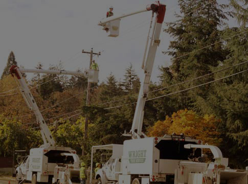
Vegetation management is an essential tool in EWEB's power outage mitigation toolbox.
As we witnessed during the back-to-back ice storms in January, hazardous falling trees and snapped branches coming down on power lines create prolonged outages and unsafe working conditions during severe weather events.
That’s why, each year, crews trim over 500 overhead 'line miles' of vegetation to minimize falling trees and branches, avoid outages and increase the electric system's reliability.
EWEB maintains over 1,300 miles of overhead transmission and distribution lines. To aid crews in identifying hazardous vegetation growth in a sometimes heavily forested service territory, EWEB is utilizing a new satellite-based forestry analytics software called Overstory.
"Using remote sensing data, we help utilities optimize resources, mitigate risk, and strategically direct the vegetation management that matters most," said Overstory Customer Success Manager Kathryn Morse.
The first year's analysis (conducted in the fall of 2023) focused on areas with denser tree coverage, like south Eugene and McKenzie River service areas. The satellite imagery captures overhead power lines with nearby tree canopies and uses technology to quickly identify areas that could benefit from additional vegetation management. It also creates a heat map of places with high tree mortality—these 'hazard' trees are more likely to fall into powerlines during severe weather.
EWEB's Resiliency Program Manager Jeannine Parisi said, "The goal is to efficiently target tree-trimming in areas of highest risk and develop an action plan to address hazard trees that pose a fall-in risk to our overhead lines. It's especially helpful for terrain that's hard to access for visual inspection."

How the vegetation intelligence works:
- It creates vegetation data from remote sensing sources (detects tree height, health, and species).
- It combines data that matters most for EWEB (pole and line location, wildfire risk maps, trim specifications, terrain, and slope maps).
- It helps build a data-driven vegetation management program (management cycle prioritization, hazard trees, encroachment, reliability forecasts, and contractor audits).

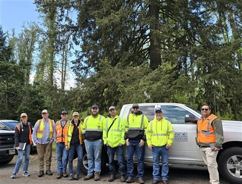
In May, the Overstory team joined EWEB's vegetation crew in the field to review the first-year data analysis. In the field, the team easily located some of the riskiest areas.
"By looking at our risk matrix, utilities can identify the amount of vegetation nearby, both horizontally and vertically, to conductors, which helps us accurately project vegetation-related outages," said Morse.

Last year, Overstory satellite imaging analyzed vegetation across 180 ‘line miles' and found that EWEB's current vegetation management practices are very effective at maintaining clearance, with just a few areas that might need additional trimming work.
"We just captured new satellite imagery to update the analysis, particularly given the amount of tree damage from the ice storm," said Parisi. Overstory will analyze about 425 ‘line miles' of EWEB's electric system this year.
This forward-thinking vegetation management tool is just one example of how EWEB proactively invests today to prepare for a resilient tomorrow.
Related Programs
Trees and power lines
Trees are a major cause of power outages in the Eugene area. To help prevent tree-related outages we proactively prune trees to help keep our equipment clear.
Wildfire safety and prevention
Community wildfire prevention is increasingly important as climate, drought and a host of other issues are converging—resulting in more frequent and damaging wildfire events.