5.1 Climate Impacts on EWEB Introduction and Policy Language from SD15
EWEB Climate Change Policy SD15: Climate Impacts on EWEB - Resiliency & Adaptation Section
Consistent with resiliency initiatives included in EWEB’s approved strategic plan, the Board directs the General Manager to evaluate and enact measures, as necessary and appropriate, to prepare for and minimize the effects of climate change that could impact EWEB’s water and electric supply and infrastructure, damaging EWEB’s resiliency and reliability.
EWEB defines resiliency as, “the ability to reduce the likelihood, magnitude, and duration of sudden or gradual disruptive events through risk mitigation, emergency preparedness and response, and recovery strategies.” The U.S. EPA, within its Regional Resilience Toolkit[1] says, “Resilience is about building the capacity of the community, at various scales, to prepare for, withstand, recover, and maintain its identity in the face of actual or anticipated hazard occurrences, allowing for continuity of community and quick recovery if a disaster occurs.”
When thinking about resiliency to both sudden and gradual disruptive events, it’s helpful to remember EWEB got its start back in the early 20th century to enable local control of vital community resources in the face of a specific public health threat. When a typhoid epidemic struck Eugene in the early 1900s, the outbreak was traced to the privately-owned water company. In response, outraged citizens voted in 1908 to buy the system and create a municipal, citizen-owned water utility. The Eugene City Council authorized the construction of a hydroelectric power plant that would power the pumps necessary to bring water to the people and then transferred control of the utility to a separate citizen board in early 1911. When the Walterville Power Plant (still in operation today) generated surplus electricity beyond what was needed for the water pumps, EWEB took the necessary steps to become the full-service electricity and water provider that it is today.
More than one hundred years later, EWEB continues to be forward-thinking in its long-range planning. The utility strives to continually serve our community with life-sustaining water and electricity every minute of every day, and into the future forever. Flexibility and adaptability in our plans and operations will be necessary to remain resilient to a wide-variety of natural and human-caused threats if we are to maintain this level of reliability for the next 100 years.

While there are many threats the utility must prepare for and work to avoid that are not directly due to climate change (such as domestic terrorism and/or cyber security threats), we know that climate change is already impacting our physical environment, our human capital, our public health, our policy landscape, and our resource availability in new and challenging ways. Often, stresses from these new challenges are layered on top of one another, and deciphering cause and effect to determine effective responses is becoming more complicated. The layering of simultaneous challenges taxes the capacity of any organization’s response. Never was this more apparent as our community struggled to respond to the intense stresses of the COVID-19 pandemic and the devastating Holiday Farm fire simultaneously in September 2020. While everyone in our community will be impacted by the physical effects of climate change in one way or another, EWEB also recognizes that the most vulnerable members of our community will be least able to prepare and adapt to this wide range of changing conditions. No matter where the challenges originate, EWEB must find new ways to increase redundancy and resiliency across the organization and throughout our infrastructure. In doing so, EWEB must consider how to support members of our community who have been historically under-served and/or are most vulnerable to service disruption, bringing an equity focus to the work.
Climate Policy SD15 requires the General Manager to evaluate and enact measures to prepare for and minimize the effects of climate change on EWEB’s water and electric supply and infrastructure. Therefore, this chapter of the Climate Guidebook will focus on resiliency initiatives related to expected changes to our physical environment in Lane County, our drinking water quality and water availability for both drinking and hydropower production, and the ability of our EWEB-owned infrastructure to adapt to changing physical conditions. This section will be expanded over time in response to stakeholder needs and feedback and as our programs grow and change in response to where the need is greatest.
Content currently included in v3.0:
- Expected physical changes from climate change for Lane County, via Oregon Climate Change Research Institute
- Lane County Natural Hazard Mitigation Plan (NHMP)and other planning efforts at the State and County levels
- EWEB’s Wildfire Mitigation Plan
- EWEB’s Watershed Protection Program
- Second Source of Drinking Water Development on the Willamette River
- Appendix C – EWEB’s Resiliency Policy (SD22)
Content planned for future Guidebook Versions:
- Link to EWEB’s Annex to Lane County’s NHMP once approved by FEMA
- SD22 Resiliency Policy implementation activities
- High-level results from EWEB’s 2025 Business Impact Analysis
- Research results from EWEB’s Forest Carbon Lab investments in partnership with University of Oregon
Explore this Webpage: 5.2 Expected Physical Changes for Lane County | 5.3 Natural Hazards Mitigation Plan | 5.4 Implentation of Resiliency Policy-SD22 | 5.5 EWEB’s Wildfire Mitigation Plan and Associated Policies | 5.6 Watershed Protection Programs | 5.7 Second Source of Drinking Water Development | 5.8 Emergency Water Stations
5.2 Expected Physical ClimateChanges for Lane County

In July 2022, the Oregon Climate Change Research Institute (OCCRI) finished a report for the Oregon Department of Land Conservation and Development called, “Future Climate Projections: Lane County, OR.” The study evaluated 12 natural hazards and related climate metrics (Table 2 in the OCCRI report) to determine if the risks in Lane County from those hazards was increasing, remaining unchanged, or decreasing and the confidence level of each. The Executive Summary of this report states:
“Climate change is expected to increase the occurrence of many climate-related natural hazards. Confidence that the risk of heat waves will increase is very high (Table 1 – see below) given strong evidence in the peer-reviewed literature, consistency among the projections of different global climate models, and robust theoretical principles underlying increasing temperatures in response to ongoing emissions of greenhouse gases. Confidence that the risk of many other natural hazards will increase as climate changes is high or medium (Table 1), reflecting moderate to strong evidence and consistency among models, yet these risks are influenced by multiple secondary factors in addition to increasing temperatures. Confidence in changes in risks is indicated as low if projections suggest relatively few to no changes or evidence is limited.
This report presents future climate projections for Lane County relevant to specified natural hazards for the 2020s (2010–2039) and 2050s (2040–2069) relative to the 1971–2000 historical baseline. The projections are presented for a lower greenhouse gas emissions scenario and a higher greenhouse gas emissions scenario and are based on multiple global climate models. All projections in this executive summary refer to the 2050s, relative to the historical baseline, under the higher emissions scenario. Projections for both time periods and emissions scenarios are included in the main report.”

The report provides ranges of impacts from projected hazards in tangible form. For example, related to the very high confidence of the increasing risk of impact from heat waves, the report states, “In Lane County, the number of days per year with temperatures 90°F or higher is projected to increase by an average of 18 days (range 5–30 days) by the 2050s, relative to the 1971–2000 historical baselines, under the higher emissions scenario.”
Links and Relevant Resources:
- Oregon Climate Change Research Institute (OCCRI): Future Climate Projections for Lane County, Oregon
- Oregon Climate Change Research Institute (OCCRI): Oregon Climate Assessments
5.3 Natural Hazards Mitigation Plan (NHMP)
EWEB has participated in the metro-area NHMP since 2009 and in 2025, joined as an annex holder to Lane County’s NHMP to consolidate regional planning efforts. The benefits of joining the County’s process include:
- Continuity of risk assessment process among jurisdictions already incorporated within the county MJNHMP – shared resources for research and analysis of risks/impacts to people and infrastructure.
- Consolidated planning efforts in response to those identified risks specific to mitigation strategies and potential regional grant project alignments and applications.
- Expanded ability to conduct capabilities assessment to a larger service area – more in line with an actual response mutual aid resource request footprint.
- Consolidated public engagement, i.e., reduction of duplicate efforts engaging with the public on same subject matters but initiated in different cycles.
- Provide for a more regional approach to partnerships for annex holders; planning, on-going natural hazard committee meetings would incorporate a larger partnership.
EWEB’s 2024-2028 Annex to the Lane County Multi-Jurisdictional Natural Hazard Mitigation Plan is currently being reviewed by FEMA. Once approved, the current metro-area NHMP will be retired.
Natural hazard mitigation is defined as permanently reducing or alleviating the losses of life, property, and injury resulting from natural hazards through long and short-term strategies. In the updated annex, winter storms, wildfire, and earthquake rank as the highest risks to the public and to EWEB utility infrastructure. Moderate risks identified include extreme heat, windstorms, flooding, landslides, and drought. Compared to the prior risk assessment, the risk score for wildfire increased while flooding and landslide risks ranked lower relative to other natural hazards. EWEB has re-evaluated the probability of potential natural disasters occurring and its response capabilities to develop a natural hazard risk rating. While climate change itself is not defined as a natural hazard, it is a contributing factor that elevates the probability and severity of different natural hazards.
The NHMP examines and prioritizes hazards to help focus risk reduction activities to protect critical infrastructure and public safety. Once approved by the Federal Emergency Management Agency, plan holders can qualify for federal and state funds appropriated specifically for NHMP mitigation projects. Since the 2020 NHMP was adopted, EWEB has been awarded over $2.5M in FEMA Hazard Mitigation Advanced Assistance funds; about $1.2 for watershed recovery and restoration work and the remainder for water transmission line feasibility studies at Day Island and Knickerbocker Bridge.
Risk mitigation action items identified in the NHMP include seismic upgrades to existing infrastructure, emergency water distribution equipment, and watershed recovery activities to mitigate future wildfires. These activities are reflected and funded through EWEB’s ten-year electric and water capital improvement plans.
Links and Relevant Resources:
- City of Eugene Emergency Plans: Eugene Springfield Multi-Jurisdictional Emergency Operations Plan, Eugene Springfield 2020 Natural Hazards Mitigation Plan, Oregon Resiliency Plan, and Neighborhood Radio Communications Response Guide
- Lane County, Oregon’s Office of Emergency Management
- Natural Hazard Mitigation Plan for Lane County, 2023-2028
- Natural Hazard Mitigation Plan for Lane County, 2018-2023
- Natural Hazard Mitigation Plan for Oregon, 2020-2025 - Oregon Department of Land Conservation and Development
5.4 Implementation of Resiliency Policy- SD22
In August 2023, EWEB’s Commissioners approved Board Policy SD22 (See Appendix C). The policy directs the organization to incorporate resiliency considerations into Strategic Plans, Long-Term Financial Plans, Capital Improvement Plans, annual budgets, and organizational goals. Implementing this policy requires risk mitigation, recovery plans for major threats, and completing Triple-Bottom-Line (TBL) assessments that include resiliency criteria when evaluating alternatives. Four focus areas for resiliency efforts are addressed in the policy including:
- Infrastructure and Systems
- Workforce
- Finance
- Community
Infrastructure investments that will provide robust service resiliency in adverse conditions were invested in throughout 2024 and additional capital improvements are planned over the next decade to continue to support service resiliency and redundancy. 2024 projects included:
- Water Storage Tanks: New seismically resilient drinking water storage tanks near East 40th Avenue were completed in March 2024. Replacement of the College Hill Reservoir is underway.
- Emergency Water Station: A sixth emergency water distribution site opened in October 2024 near the YMCA.
- Willamette Water Treatment Plant: Early design for a redundant water source on the Willamette River is underway, with construction expected in 2026 or later.
- Currin Substation: Rebuilt and placed back into service in Q4 2024, enhancing grid reliability.
- Smart Meter Deployment: By Q3 2024, 98% of customers had smart electric meters, and 85% had smart water meters, supporting efficiency and resilience.
- Generation Resource Management: Significant investments in infrastructure, including turbine rebuilding at Carmen Powerhouse and control system upgrades at Trail Bridge, were completed. Natural resource enhancements also advanced.
In addition, planning efforts are underway to support a business impact assessment and workforce succession planning to evaluate and plan for exposures in our key service lines in 2025.
5.5 EWEB’s Wildfire Mitigation Plan and Associated Policies

All Oregon electric utilities are required to develop a risk-based Wildfire Mitigation Plan (WMP) and submit the approved plan to the Public Utility Commission (PUC). The EWEB Board approved the utility’s first WMP in July 2022 and agreed to an annual cadence for plan updates. The second plan, developed with the benefit of fully adopted regulatory requirements, was approved in July 2023.
Understanding areas of high wildfire potential across the electric system is critical to effectively target key locations and mitigation investments. Most of EWEB’s electric infrastructure is in urban areas with relatively low risk for wildfire. Areas currently deemed to have heightened risk include the McKenzie River Valley and a portion of southeast Eugene.
In 2024, EWEB secured third-party fire risk modeling expertise using the most current data to validate and refine our High Fire Risk Zones. The 2024 WMP was delayed while this analysis was underway, and results will be incorporated in the upcoming 2025 plan.
The increasing frequency of extreme weather events, shifting regulatory environment and threat of natural disasters is prompting EWEB to adapt its operational practices while making strategic investments to maintain public safety and improve resiliency. Wildfire is now impacting EWEB assets, operations and customers on a near-annual basis. Addressing this growing threat requires accelerated implementation of multi-hazard risk reduction strategies as well as on-going maturity of our WMP.
EWEB’s WMP’s comprehensive approach to wildfire risk reduction includes:

EWEB has allocated $1 million as a funding floor specific to wildfire mitigation activities, including wildfire cameras, weather stations and forecasting, enhanced inspections, and multi-hazard reliability projects. Grant funding has been sought to accelerate mitigation work, supporting fuels reduction and grid hardening efforts. Community engagement and interagency coordination is an essential component to the planning effort. In 2023, EWEB launched a new program to offer extra support to customers who rely on electricity for medical equipment and mobility devices during a Public Safety Power Shutoff (PSPS) event.
Links and Relevant Resources:
- EWEB website: Wildfire Safety and Prevention
- EWEB Wildfire Mitigation Plan, 2023-2024 (adopted July 11, 2023)
- EWEB Wildfire Mitigation Plan, 2022 (approved July 5,2022)
- Oregon SB 762: Wildfire Preparedness
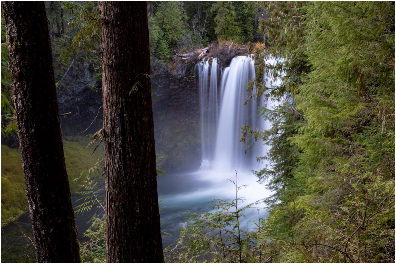
5.6 Watershed Protection Programs
In the 2019 State of the McKenzie Watershed Report staff indicated, “it is anticipated that climate change impacts in the McKenzie will show up as extreme weather events (including flooding, drought, and loss of snowpack), resulting in increased wildfires, harmful algal blooms (HABs), and property damage in riparian and floodplain areas.” The 2020 Holiday Farm Fire (HFF) was an example of such an extreme event that continues to have a significant impact on the McKenzie Watershed. 2023 brought another round of wildfires to the Upper McKenzie, adding to the already sizeable portion of total acres burned throughout the watershed over the past 7 years. Since the HFF, EWEB has been hard at work mitigate the water quality threats from these fires by working closely with our federal, state, and local partners in a well-coordinated response and restoration effort.
Although the McKenzie River has faced some major challenges over the past several years, overall water quality remains excellent.
The overarching goal of EWEB’s Drinking Water Source Protection (DWSP) program is to maintain our community’s exceptional water quality. We do this by maintaining the balance between watershed health and human use over time. To meet this goal, we aim to:
- Plan and implement actions that maintain source water quality in a way that balances risks with benefits in partnership with others;
- Prioritize source protection efforts that provide the greatest benefit to drinking water treatment and electric generation in the McKenzie Watershed; and,
- Promote public awareness and stewardship of a healthy watershed through actions and programs.

Activities included in the Drinking Water Source Protection program include:
Water Quality Monitoring
EWEB’s Source Water Protection Program undertakes multiple long-term monitoring efforts year-round to assess water quality conditions throughout the watershed. Water quality conditions are tracked through a combination of extensive continuous monitoring stations and discrete sampling. The results are used by staff to better understand overall watershed health, contaminant sources and emerging drinking water threats. All routine baseline sampling events were completed as scheduled in 2024. Key items of note for 2024 include:
- Overall, water quality remains excellent in the McKenzie River. Water quality conditions tracked throughout the McKenzie Watershed during 2024 were largely unremarkable, apart from significant early January and late December storm events, which resulted in elevated turbidity and high flows throughout the watershed. Even the monitoring sites within the watershed with lowest relative water quality rank would generally still meet most drinking water standards before standard treatment.
- A prolonged series of winter storms that extended into early spring kept snowpack levels healthy and supported McKenzie River flows that stayed closer to median values throughout the first half of the season, which can help improve instream temperatures and overall water quality.
- Primary nutrient levels (nitrate, total phosphorus, orthophosphate) across the 6 mainstem McKenzie River monitoring sites stayed at or below 60 ug/L during all quarterly baseline sampling events, with the exception of nitrate levels during the final baseline event in November. For this particular event, nitrate values climbed to 100 ug/L or more for all mainstem baseline sites, which is not typical, but also isolated to one event. A combination of prior precipitation across recently burned areas might be a contributing factor to the elevated nitrate levels. Staff will continue to monitor nitrate levels into 2025.
- Baseline mainstem metal concentrations stayed well below all applicable drinking water MCLs.
- A new permanent water quality monitoring station was installed at Quartz Creek. Quartz Creek was extensively burned during the Holiday Farm Fire and is currently undergoing a largescale floodplain restoration effort. This builds on the continuous water quality monitoring network expansion in 2023 to include Keizer Slough.
Hazardous Materials and Spill Releases
EWEB tracks hazardous spills to respond for mitigation, assess watershed impacts, and notify water treatment operations of potential impacts. There were six reported incidents in the McKenzie Watershed in 2024 that EWEB Source Protection staff tracked for potential water quality contamination in the McKenzie River. However, none of the incidents resulted in observed releases of hydrocarbons (fuel or oil) directly to the McKenzie River, and most involved single vehicles.
EWEB conducts an annual spill drill with a wide array of partners. The 2024 spill drill involved over 40 participants, representing 10 different agencies or organizations, including staff from the cities of Medford and Salem. In addition, in 2024 EWEB staff also assisted City of Medford staff and other Rogue Valley partners as they work to develop similar spill response capabilities to protect their drinking water intake on the Rogue River.
Illegal Camping
EWEB’s Source Protection staff continue to partner with Willamalane Parks, City of Springfield, and Lane County to reduce the impacts of illegal camping and dumping in riparian areas along the McKenzie River immediately above EWEB’s intake.

Pure Water Partners Program
The Pure Water Partners (PWP) Program was originally designed to reward McKenzie landowners for protecting high quality forest land along the river and assist landowners in restoring degraded areas to help EWEB protect water quality and avoid increases in future water treatment costs.
Following the 2020 Holiday Farm Fire (HFF), the Pure Water Partners program shifted its focus to carrying out restoration activities on properties impacted by the fire. This included erosion control, replanting in riparian areas, invasive vegetation removal, fire fuels reduction and nature scaping.
In 2024, PWP planted approximately 98,000 native trees and shrubs on 83 properties in the watershed. In addition, contractors treated invasive species on nearly 100 properties. Nine landowners worked on naturescaping projects this year.
As of the end of 2024, the PWP has planted a total of 982,000 native trees and shrubs on landowner properties affected by the fire. Currently, over 230 landowners have signed 7-year watershed stewardship agreements under the PWP program.
The PWP program completed a 5-year strategic plan in 2024. The program is transitioning out of the post-fire ‘response and recovery’ mode and will be focusing on engaging landowners with riparian properties upstream of EWEB’s drinking water intake (instead of solely focusing on the HFF burn area). All work conducted under the PWP program with landowners is completely voluntary.

Septic System Assistance Program
Since EWEB began its Septic System Assistance Program in 2008, over 1,100 septic systems have been inspected and pumped out and a number of systems were repaired as needed. EWEB offers a rebate program for homeowners within proximity to the McKenzie River with a $300 rebate to have their septic systems inspected and pumped out, if needed. There were 56 homeowners who took advantage of this incentive in 2024. EWEB also offers a zero-interest loan program that allows homeowners who need to make major repairs or replace their septic tank or drain field to apply for a zero-interest loan of up to $20,000 from EWEB. Forty-four zero-interest loans have been issued to McKenzie homeowners since the beginning of the program, with 30 of those loans going to homeowners affected by fire. Three zero-interest loans were issued this year.
Links and Relevant Resources:
- EWEB Website: Fire Recovery and Watershed Restoration
- 2020 EWEB State of the Watershed Report
- 2021 EWEB State of the Watershed Report
- 2022 EWEB State of the Watershed Report
5.7 Second Source of Drinking Water Development
For more than 100 years, the community of Eugene has relied on the McKenzie River as our only source of drinking water. Other cities in the valley get their drinking water from the Willamette River. After years of careful planning for the future, EWEB will join Corvallis, Wilsonville, Hillsboro, Beaverton, and other communities by tapping into this high-quality water source.

The proposed intake is near the confluence of the Coast and Middle Forks. Immediately upstream of the intake is the 1,300-acre Willamette Confluence Preserve, important floodplain lands, owned by the McKenzie River Trust (MRT). Having the Confluence Preserve upstream of the intake is ideal to maintain high water quality.
EWEB submitted a Joint Permit Application in September of 2024 to the U.S. Army Corps of Engineers and Oregon Department of State Lands to address environmental permitting for the project. As the permitting process continues, EWEB will move forward with the detailed design of the new plant, associated pipeline, and water intake structure. Construction is not anticipated to start until at least 2026. Water from the new plant is projected to be introduced to the system around 2029.
5.8 Emergency Water Stations
In 2017, Commissioners directed staff to focus on developing Emergency Water Stations using well water as a source of supply. Since then, EWEB has worked with community partners to construct seven geographically distributed emergency water distribution sites throughout the community, see the map for locations. Together, the stations are capable of supplying two gallons of water per person per day to everyone in Eugene during an emergency. A demonstration event for the final station at Kennedy Middle School is tentatively planned for the fall of 2025.

Links and Relevant Resources:
[1] EPA Regional Resilience Toolkit, July 2019: Regional Resilience Toolkit: 5 Steps to Build Large-Scale Resilience to Natural Disasters (epa.gov)